Description
eBook Order #: CCP5787
Print Book Order #: CC5787
Both eBook & Print Book Order #: CC+P5787
ISBN13: 978-1-55319-550-4
Grades: 3, 4, 5
Reading Level: 3-5
Total Pages: 60
Author: Paul Bramley
UPDATE: To utilize the Explore with Google Earth features, please download Google Earth™ Pro at google.com/earth/about/versions/#earth-pro, then follow the instructions to install it.
Highlights:
• Basics of Map Reading
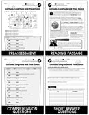
• Latitude, Longitude & Time Zones
• Map Geographical Features
• Map Cultural Features
• State Capitals
• World Countries
• Time Zones Map
Extend the basic knowledge of map reading to give your elementary students a thorough understanding of maps.
Our resource allows students to learn in-depth how to read and create maps. Explore all the elements on a map, such as scale, index, grid system, and surrounding area. Take your understanding of a grid system one step further by examining lines of latitude and longitude. Compare the different times zones found in your country. Learn about topographic maps before exploring steep and gradual elevations in Google Earth. Draw a map of a rural and urban area to see the differences created by cultural features. Compare the climate of different areas of your country before heading to your hometown and examining the weather through Google Earth. Label a map of the world according to temperature, such as tropical, mild, cold, or polar. Aligned to your State Standards and written to Bloom's Taxonomy, additional map activities, crossword, word search, comprehension quiz and answer key are also included.


